Griffith 2009 Christmas Letter
The passing of another wonderful year since last years
letter. This year feels slightly skewed for some reason, as if its passed by too quickly, full of too much and yet its passed and all but gone. Time to reflect and look back on the way the year went. The summary hasn't changed much from last year : family, outdoors, church and work,
but this year with a dose of marriage. (There are 275 hyperlinks in this letter, I dare you click on 10)
Family Review
January


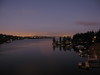
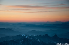
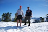
Last December we had a
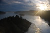
true white Christmas as snow fell, even in the lowlands of Seattle, the mountains were full of snow. In
January we had a
pineapple express blow through which brought tons of warm rain which melted all the snow and caused
lots of flooding throughout the area and we had
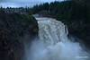
chance to help clean up. (Don't miss raging
Snoqualmie Falls) Mark and Stac met
Tom and Celest in Everett to see world reknowned mountain climber
Carlos Buhler speak, he was very interesting and inspiring. Mark bribed Miles and Sofi with
Pho if they go on a
hike over Squak Mountain. Mark made
another trip to Japan where the
food was fantastic, especially the
Anonymous Ramen. Favorite highlights of Japan were the
tiny hotel and the
Tsukiji Fish Market and
sushi for breakfast.
February


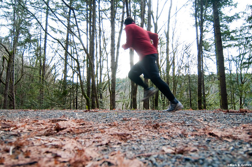
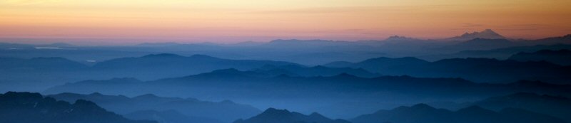
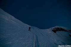
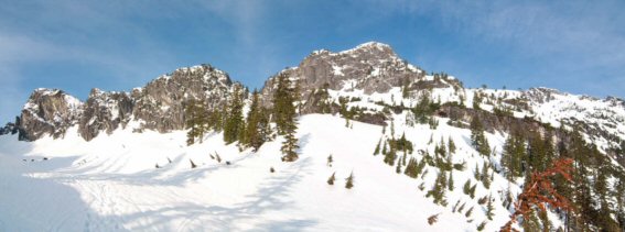
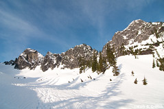
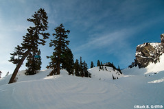
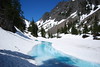
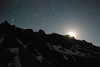
In February the cold crisp mornings made for beautiful
Dawn Patrols. Fog blanketed the area which made for cool
photos and
running. Somehow we ended up with yet
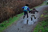
another cat bringing the total to 2. For mid-winter break the family drove out to the
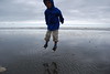
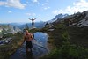
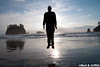
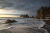
Olympic Peninsula where we had fantastic weather. The girls did the Twlight tour in Forks. Despite being winter it was warm enough at 2nd Beach Miles
stripped down to his underwear. The
sunset at Ruby Beach was one of the most amazing we've seen. More
hiking with the kids, and Mark and Miles went on the annual winter
snow campout with the young men up to Snoqualmie Pass.
March


March brought a ton more snow, even in the
lowlands. Miles went with Dad to the Doctor for a
check up, Dad took his camera of course. Cold weather meant lots of eating Pho, and if you don't know what that is your missing out,
video showing how Pho is made. Mark got a
new pair of glasses. Sofi and Dad went for a
nice run on Cougar Mountain. The family drove to Yakima to watch Kiah preform in
State competition for Drill and Pom. Of course more
hiking with kids on Cougar. On the last day of March
Seth and Mark
camped up at Commonwealth Basin and got dumped on with a foot of snow.
April


Kiah
turned 17, whew! (we are getting old) and its Spring Break time. The family headed for the
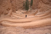
big island of Vancouver. We had a fantastic time, we
backpacked to Mystic Beach where we camped on the beach for two days with beautiful sunshine weather (
see the video) and spent a day in Victoria. Mark and Miles joined the young men
camping at Ancient Lakes in
Eastern Washington where they built
huge fires and
hiked and even swam. Great clear weather in March made for some
beautiful Dawn Patrols, and Mark went on a cool hike with the Young Men up to the
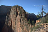
Tiger Mountain Caves.
May


May started out with an
International Dawn Patrol with some work mates visiting from Tokyo.
Spring came in force to the local foothills where we live. Somehow our pet count grew by 2 with some
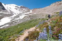
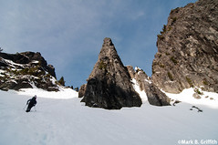
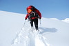
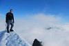
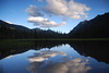
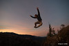
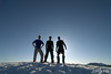
little guinea pigs. Seth took Mark on his first real alpine
climb up to The Tooth in Snoqualmie Pass. Mark's
Grandmother Smith passed away and the family drove to Idaho to commemorate her passing where we saw lots of family and relatives from long long ago. On our way back we stopped by
Wyoming to visit Seth and Amy. At work Mark and crew started the official
run and plunge where during lunch they run down to Lake Washington, jump in and then run back to work. And Miles and Mark when on their
5th annual Father and Sons outing at Ensign Ranch.
June


The summer started heating up in terms of activities. The wedding theme begins with Mark and Sofi flying back to Idaho to attend cousin
Alyse's wedding to Adam Hassel. A week later the wedding themed continued as Mark and Stacey flew to the Yucatan Peninsula in
Mexico to celebrate their 20th wedding anniversary. (See told you we were getting old) They drove a
1000 miles and saw four different ruins. (
Check out the video). Unfortunately on Stac's 41st birthday at their last ruins on the last 3 steps Stac twisted her ankle and tore ligaments. That evening after Stac's birthday dinner Mark spent some time laying on the floor of the bathroom hugging the toilet as Montezuma got his revenge for eating that salad. Mark and Stac
convalesced on the beach until they flew home. Back home Mark climbed
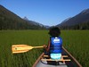
The Tooth again with Adrian from work. To close out the month Miles and Mark went
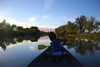
canoe camping up at Cooper Lake where they met
George and Cherry.
July


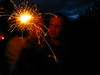
We celebrated the
4th of July at the Self's eating good food and shooting off a lot of fireworks. Stac continued to have major pain from her ankle and found out she'd have to have surgery to repair things in August. While she spent most of the month in bed : Mark left with Kiah and the youth in our church to go on
Trek, a reenactment of Mormon pioneers pulling handcarts in Eastern Washington. Mark went as the Trek photographer, where he took over 4000 photos; he spent days after his return making the 1100 photos available, creating a slide show and eventually four videos (
1,
2,
3,
4 ). The day Trek ended, Sofi, Mark and Kiah drove to
The Gorge to see
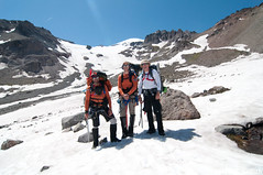
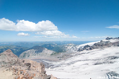
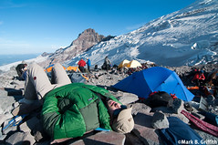
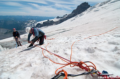
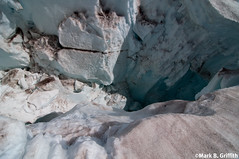
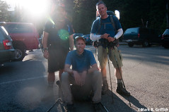
Coldplay in concert (what a venue, what a concert!). Three days later Mark departed with
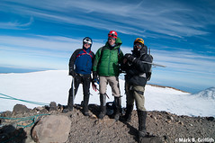
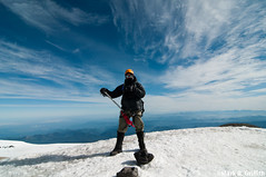
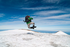
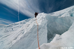
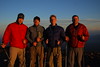
Seth and
Dean to
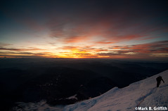
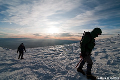
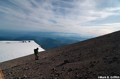
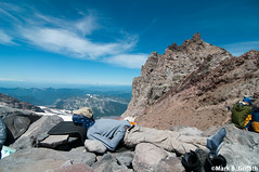
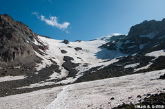
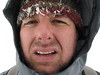
climb Mt. Rainier, 14,410 feet is a long way up. At the end of July Stac went in for
surgery on her ankle, things went well but the pain continued after surgery for a bit.
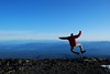
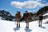
August


Summer in full force, the prime hiking weather Mark hiked 60 miles, 16 of those with Miles. Miles and Mark took a
canoe camping trip with the scouts in early August. In a single week (before work or on early morning Saturday's) Mark hiked to the summit of
4 local peaks (
Red Mountain,
McClellan's Butte,
Kaleetan and
Kendall Peak). With all the sun the berries ripened and the family harvested a huge
bunch of blackberries and made fresh
blackberry jam. Miles joined Dave Young to take the Beraiult kids
fishing at Alice Lake, Miles and Dad got skunked but had a great time canoeing about. The end of August brought about the annual Dr's visits and shots,
Dad of course brought his camera. Sofi turned
10 years old and had a great party with her friends. We attended the
Bellevue South Stake summer picnic, great games and good food, the pie eating contest was good times. The second to the last day of August Stac got her
cast off (the leg hair was gross!) and she badly wanted to salvage the last gasp of summer. On a whim right after church she wanted to go camping, so we threw everything the car, put the canoe up on top and drove up to
Tucquala Lake. We had a grand time, (
video).
September


Summer ended and
School began, Miles entered kindergarde,
Sofi entered the 5th grade and Kiah a Senior in High School. We celebrated Labor Day by a
wet rainy hike and ribs and harvest dinner. Fall continued the berry season we drove up to our favorite
huckleberry patch for our annual berry picking and we got a ton of berries; the
huckleberry pancakes were particularly delicious. Miles and Mark went on a
campout up to Lake Melakwa where they got
rained on a tad bit, though they did get in the
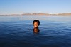
last swim of the season in a mountain lake. The first official day of fall was still warm enough to
swim at work during lunch runs. Mark couldn't stand the fabulous weather and took a day off work at the end of September to
day hike to Mt. Daniel, despite forgetting a pack (he made one from a tent bag and a shoe string) the weather was fantastic.
October


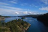
Mark went with Sofi's class on a
marine science field trip in the sound, they dredged for plankton and explored live samples from the seabed.
Salmon Days in Issaquah started off again with a great parade where
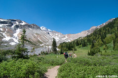
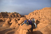
Kiah preformed with the Drill Team. That weekend Mark went with his boss on a 19 mile
day hike through the Enchantments in the Cascades of Washington. A light dusting of snow made for beautiful scenery with the
yellow larch trees. Mark took
Kiah's senior photos this year and she was happy with how they turned out. The end of October brought again the time for the annual trip to the
pumpkin patch, good to see friends, ride in the wagon and pick pumpkins. The family gathered for our
annual pumpkin carving and the
pumpkin photo. The
trunk or treat party at the church had some great costumes this year and of course the kids gathered pounds and pounds of candy. This year Mark refrained from confiscating (stealing) any of his kids candy.
November


 Miles turned 6
, he's four years behind Sofi and only 4 inches shorter. He had a great birthday party at Kidz Bounce, he loved his
Wall-E cake. In early November
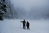
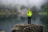
Jay Wiser was in town visiting family and joined Mark on a snowy hike up to
Snow Lake. At the end of the month Mark turned 42 and did the annual hike up to
Mailbox Peak (4000 vertical feet in 2.5 miles), three started and only one made it to the top (it was the old guy). Mark spent the rest of his birthday at the elementary school photographing
Miles Thanksgiving Party and
Sofi's classroom. We spent Thanksgiving at home in Washington, which meant we got to play in the
greatest muddiest Turkey Bowl ever.
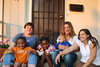
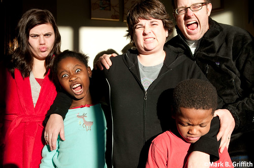
Doug and Julie joined us for Thanksgiving, Sara was supposed to join us with her family but let a little thing like getting her gallbladder removed stop her.
December


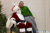
For Christmas Mark bought himself a new camera and a set of off-camera lights. This was all in preparation for the annual
church Christmas Party and the
Santa photos. We had unusually cold weather and that froze everything in the mountains solid and made for some
great hiking weather. Kiah and the Drill Team took first place in the
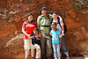
Hazen competition. A week before Christmas the family drove down to Sacramento to attend
Megan Scott's wedding (Stac's brother's Craig's eldest daughter). Mark had a tooth ache days before and they arrived in California after driving all day just in time for him to get a
root canal. Megan had a beautiful classy wedding, her
dress was gorgeous and we are glad we got to close out the year on the wedding theme. The family drove back home to get ready for the holiday season. We started what is maybe a new tradition this year riding a ferry out to see the
boats on Christmas parade on Lake Union.
Christmas was a wonderful day, though we missed Stac's folks this year. Mark used his new camera and lights to take some
new born baby photos of the new Schill baby and we closed out the year with a great night out in Bellevue, enjoying food, shopping and
ice skating before a
New Years Party at the Chamberlains.
Mark


(Here it goes in third person again, its a tradition after all) Mark started off thinking he'd
run to work once a week which lasted around 3 weeks till his knees started hurting and he cut back on that. He did however manage to still complete another
1000 miles under his own steam, though he fell behind a bit and the last day was 24 miles. Along the way he saw so many beautiful places and he took a couple of photos (he posted 4260 on Flickr, though he selected a
116 favorites). Mark continues to enjoy reading and seeing movies, though he seems to have less time for those activities with all the hiking and his serving in the church. Mark enjoyed all the time he and his family spent camping this year. The personal highlight was
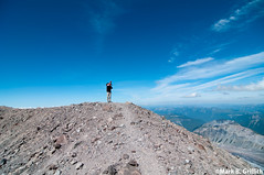
celebrating 20 years with Stac. The highlight of Mark's outdoor was first
climbing The Tooth with Seth, and then
climbing of Rainier with Seth and Dean. Definitely one of the hardest thing's he's ever done but what a great sense of accomplishment. Mark bought yet another new camera for Christmas this year, the
Nikon D300S and has started working harder on improving his photography skills and confidence. Mark continues to enjoy
shooting and editing videos with his cameras. Work continues to go well at
Amazon, where he still works on the
Fulfillment By Amazon program. He looks forward to next years adventures with friends and most of all family.
Stacey


2009 has had it's ups and downs for me and to be honest I'm very glad to say goodbye to it. I'm grateful for this past year for many reasons though. First that Mark continues to have a job that he loves and supports the family so that I can be home with the kids. Secondly (despite some injuries) we are all healthy within our family and our extended family. Thirdly, we continue to have peace and happiness in our home, though life itself can be chaotic. There are a few highlights and lows that taught me many things this year.
1. I continue to read and learn and in a year that has been a bit tough, it has kept my brain from turning to mush.
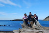
2. I loved our backpacking trip to Mystic Beach on Vancouver Island. There are moments in the day (though it was 9 months ago) that I still think of some part of that trip. It was difficult for me and I survived it, maybe that's why it keeps popping up in my mind. I had bronchitis and it was a steep hike down to the beach,which meant a steep hike back out. Doing that while not being able to breathe very well and not being in the best of shape was not easy. It was one of the funnest camping trips for the family and for me. It's a beautiful beach and we pretty much had the whole beach to ourselves. We played games, ate yummy food (yes you can eat yummy food while backpacking) and soaked up the sun that we hadn't seen all winter. It was a beautiful trip with kids. The last couple of days we spent in Victoria, BC and we had a lot of fun.
3. Mark and I celebrated our 20th anniversary in Cancun, Mexico. It was beautiful and such an adventure. We rented a car and drove all over. We saw 4 different ancient ruins. It was fun to drive around with no kids yet feeling like kids ourselves exploring many cool places. Two highlights for me from that trip was our anniversary day and the Hacienda we stayed at that Mark had booked for us. He had a dinner set up for us on our Veranda and it was romantic and beautiful. Seeing the ruins in Uxmal was amazing. For me they were the coolest ruins; I loved the feel and the layout. The worst two parts of that trip were me falling off a normal step (after climbing steep steps at the ruins) and doing serious damage to my foot and ankle (on my birthday) and Mark getting food poisoning (also on my birthday). I spent the last two days on my behind at one of the nicest beaches we'd seen the whole trip and Mark spending it with no energy after being sick all night long. It was the worst ending to the best trip.
4. I was in a boot/cast/boot from June to September. Not a highlight but it taught me many things. I read a lot, watched way too much tv, cried more than I have in a long time and the experience made me a bit more patient (just a bit:)). It also made me very grateful and realize that my foot and having surgery on it was minor, life could be much, much worse. It also taught me to rely more on others and that my family is there for me no matter what, and no matter how much I complained. I'm very grateful for them and love each one very, very much.
5. The new school year brought big changes. Kiah started her senior year at IHS (don't get me started with the tears), Sofia is in her last year in Elementary school and Miles started Kindergarten. Though I get a bit sad at times thinking of all the changes they are making, I can't help but be excited for each one and the adventures that lay ahead for them. This means changes and adventures for me as well. I've been looking forward for some time now to go back to school and finish my degree. I haven't taken classes since 1992. Wow, that's scary. I'm ready though and I get excited just thinking about it.
" The object of a New Year is not that we should have a new year. It is that we should have a new soul".
G. K. ChestertonKiah


Kiah turned
17 this year and is a senior in High School. She's active in school serving on the student body planning assemblies and school dances, she's also on the
drill team again this year. They took
first place at their Hazen competition this fall and look forward to going to State competitions in the spring. Kiah totalled her little VW Bug this year by running into a curb and ripping off the fender, ruining the axle and tearing a hole in the radiator. She inherited her Dad's 2001 Honda (and he got himself a "new" used Forrester). Kiah continues to do well in school and seminary and has applied to five different universities for next year, she's been accepted to all of them and is leaning towards BYU-Idaho even though her parents tried to convince her to go to USU. She's looking forward to graduating and going away this fall to school.
Sofi
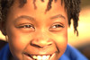


Sofi is 10 this year and continues to be a bright joy around the house. She does continue her stubborn streak and if she gets in a funk, oh boy watch out. She is doing very well in school and has really taken to reading this year. She loves her teacher Mr. Arthur and is enjoying being top dog in 5th grade at Elementary school. Sofi is active in her
gymnastics class, she moved up level this year and is now practicing on the bars, her coach works them hard at practice. Sofi continues to be the artist of the family she loves to create, whether its drawing or crafts or cooking. Sofi convinced her Dad to get
guinea pigs this year, though the thrill quickly wore off and they are now with another family. She also really really really wanted a puppy for Christmas but Santa didn't deliver, though she's convinced that when Kiah leaves for college she gets one. We'll see....
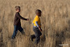
Miles


Miles is 6 this year and started kindergarden (he has a late November birthday). After one day at school he decided he didn't like it and Miles spent a couple of days running away from Stac when she tried to drop him off and a day sitting in the hallway at school with Dad. Eventually class grew on him and now he gets ready two hours early. He is growing like a weed, he'll soon pass Sofi in height. His love of Transformers, Ben 10 Alien Force, and Star Wars, Legos and Bionicles, Spiderman and Batman continue. He did tell me this year that he thinks Batman isnt' real though. He continues to make
Iron Man costumes and forts out of boxes and blankets. Miles continued going on hikes and camping trips with his Dad, he even did a 14 mile hike this summer with Dad, though he
zonked when they got to the lake for 45 minutes.
We had a great 2009 and look forward to 2010! You can find us on the Internets... Mark on
Facebook and Mark on
Flickr. Stac on
Facebook and her
blogHappy Holidays!